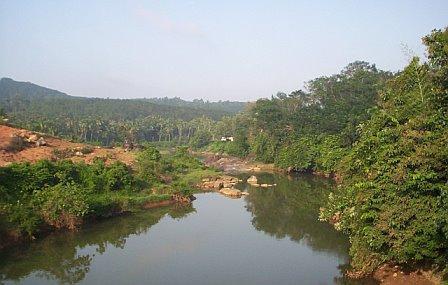
Monday, August 12, 2013
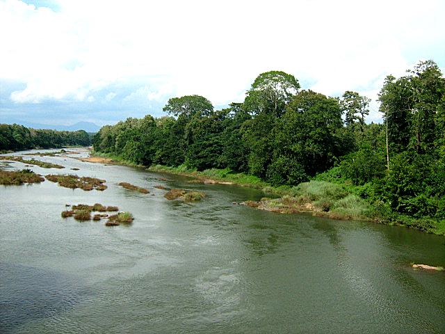
Ithikkara River


  • Ithikkara River
  • Ithikkara River is a 56 km long river in Kerala, India. It originates in Kulathhoopuzha hills in the western ghats flows through Kollam District,

    Paravur Kayal
  • Korapuzha


  • Korapuzha River
  • Korapuzha also known as Elathur River is a short river of 40 km, with a drainage area of 624 km², flowing through the Kozhikode district of Kerala state in India.

    Length: 
    40 km

     Arabian Sea
  • Karamana River


  • Karamana River
  • Karamana is a river flowing through the city of Thiruvananthapuram in Kerala, India. The river starts near the southern tip of the Western Ghats at Agastyar Koodam.
  • Kadalundi River


  • Kadalundi River
  • Kadalundi River is one of the four most important rivers flowing through Malappuram district in the Indian state of Kerala. The other three are the Chaliyar, the Bharathappuzha and the Tirur River. Wikipedia
    Length: 130 km
    Basin area: 1,122 km²
  • Kabini River


  • Kabini River
  • The Kabini, also called Kabani and Kapila, is a river of southern India. It originates in the Wayanad District of Kerala state from the confluence of the Panamaram River and the Mananthavady River, and ... Wikipedia
    Source: Pakramthalam Hills
    Mouth: Bay of Bengal
    Cities: MananthavadyValadPayyampallyKuttiyadiKorome

  • Kallada River


  • Kallada River
  • The Kallada River is one of two major rivers that flow through the Kollam District of Kerala, India. Wikipedia
    Length: 121 km
    Source: Kulathupuzha hills
    Mouth: Ashtamudi Lake
    Country: India
    Cities: KollamPunalurKottarakkaraPathanapuramKallada,Kunnathur, Tirupur

  • Chalakudy River


  • Chalakudy River
  • Chalakudy River or Chalakudy Puzha is the fourth longest river in Kerala, India. The river flows through Palakkad district, Thrissur District and Ernakulam District of Kerala. Wikipedia
    Length: 130 km
    Basin area: 1,704 km²
    Source elevation: 1,250 m
    Mouth: Arabian Sea
  • Chaliyar

  • Chaliyar
    River
  • Chaliyar is the fourth longest river in Kerala at 169 km in length. The Chaliyar is also known as Beypore River as it nears the sea. Wikipedia
    Length169 km
    Source elevation2,066 m
  • Bharathappuzha

    Bharathappuzha River 

    Bharathappuzha, also known as the River Nila, is a river in India in the state of Kerala. 

    With a length of 209 km, it is the second-longest river in Kerala, after the Periyar River.

     The word "Nila" indicates the culture more than just a river. 

    Length: 209 km Basin area: 6,186 km² Source elevation: 2,461 m Source: Anaimalai Hills Mouth: Arabian Sea

    Periyar River

     Periyar is a river that flows in the states of Tamil Nadu and Kerala, India. It is one of the few perennial rivers in the region and provides drinking water for several major towns. Wikipedia Length: 244 km Discharge: 295 m³/s Source elevation: 1,830 m Source: Sivagiri Hills Mouth: Arabian Sea Country: India

    Saturday, August 10, 2013

    pamba


  • Pamba River
  • Pamba River is the third longest river in the South Indian state of Kerala after Periyar and Bharathappuzha and the longest river in the erstwhile princely state of Travancore.

    Sabarimala temple dedicated to Lord Ayyappa is located on the banks of the river Pamba.The Pamba is considered as the Dakshina Ganga (Southern Ganges) due to its association with Kerala's Largest Pilgrim Centre - Sabarimala.The River Pamba enriches the lands of Pathanamthitta District and the Kuttanand area of Alappuzha DistrictPampa originates at Pulachimalai hill in the Peerumedu plateau in the Western Ghats at an altitude of 1650 metres and flows through Ranni, Kozhenchery, Tiruvalla, Chengannur, Kuttanad, Karthikapally, and Ambalappuzha Taluks and finally empties into the Vembanad Lake.A famous Anjana temple is situated near this bank. This river enriches the Pathanamthitta, Alappuzha districts of Kerala state.

    Kuttanad, an important rice cultivating area in Kerala gets the irrigation water from the Pamba river. The Pamba basin is bounded on the east by the Western Ghats. The river shares its northern boundary with the Manimala River basin, while it shares the southern boundary with the Achankovil River basin.Lord Ayyappan (Sri Dharmasastha) appeared to the Pandalam Raja as a child on the banks of the Pamba River.
    The Pamba River has been venerated as Dakshina Ganga, and devotees of Lord Ayyappan believe that immersing oneself in the Pamba is equivalent to bathing in the Holy Ganges River
    Discharge: 109 m³/s
    Length: 176 km
    Source: Pulachimalai Hill
    Mouth: Vembanad
    Country: India
    Cities: PathanamthittaChengannurKuttanadKozhencherry,AmbalappuzhaAyroor